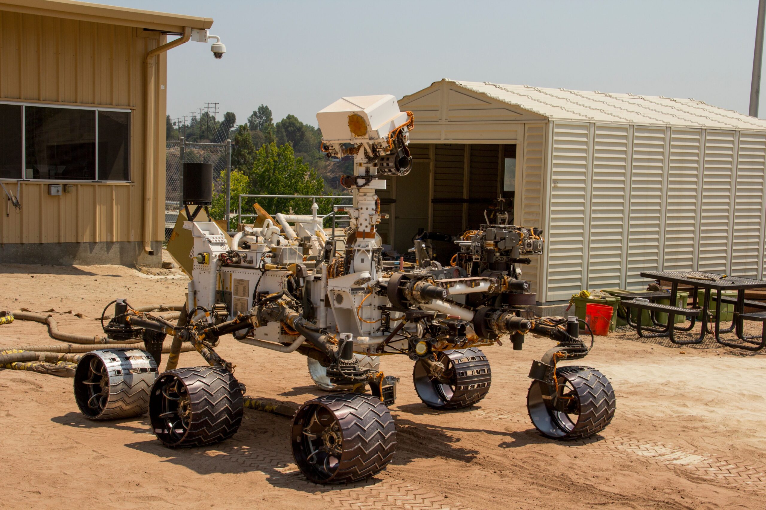
On December 8, 2025, NASA’s Perseverance rover travelled 210 metres across the rim of Jezero Crater using waypoints generated by artificial intelligence. Two days later, it completed a second traverse of 246 metres. NASA described them as the first drives on another world whose routes had been planned in this way.
The milestone is real, but the phrase “AI-planned drive” needs unpacking. A generative model did not sit aboard Perseverance and take unrestricted control of its wheels. The model worked on Earth, examining orbital imagery and terrain data to propose a continuous path and a sequence of waypoints. Engineers then tested the commands in a digital replica of the rover before transmitting them to Mars. Perseverance’s established AutoNav system still made local driving choices as it encountered the ground.
The finding is worth taking seriously, but it should not be read as the final word. This was a two-drive engineering demonstration reported by NASA, not a peer-reviewed comparison establishing that generative AI can replace human rover planners across every landscape and mission condition.
Two drives on the western rim of Jezero
NASA’s Jet Propulsion Laboratory set out the details in a January 30, 2026 agency announcement. The demonstration was led from JPL’s Rover Operations Center in collaboration with Anthropic, using the company’s Claude vision-language models.
The first drive took place on sol 1,707 of the mission, December 8 on Earth. With the generated waypoints stored in memory, Perseverance drove 689 feet, or 210 metres. On sol 1,709, December 10, it travelled 807 feet, or 246 metres. The second drive lasted about two and a half hours. Together, the two routes covered 456 metres along the rocky Jezero rim.
The distances were not themselves unprecedented for Perseverance. The important change was how the strategic route had been prepared. For nearly three decades of Mars rover operations, human drivers have studied terrain and spacecraft-status data, sketched a route and selected the waypoints that define it. Those plans are then sent across interplanetary space for the rover to execute.
For these two drives, a generative system performed much of the route-analysis task normally assigned to those planners. It used high-resolution orbital images from the HiRISE camera aboard NASA’s Mars Reconnaissance Orbiter and slope information derived from digital elevation models. The model identified bedrock, outcrops, hazardous boulder fields, sand ripples and other features, then built a path through them.
A waypoint is a strategic instruction, not a turn of the wheel
A waypoint is a fixed destination where the rover takes up a new set of instructions. Human planners typically place them no more than about 100 metres apart, according to JPL, so the route does not ask the rover to cross too much uncertain terrain at once.
Generating those points requires several kinds of judgement. The plan must make progress toward a scientific destination, avoid terrain that is clearly unsafe from orbit, respect operational constraints and leave enough room for the onboard system to manoeuvre. A short geometric line is not necessarily a good rover path. Sand, sharp rocks, steep cross-slopes and dense boulder fields can turn an apparent shortcut into an unacceptable risk.
Vision-language models are designed to work across images and text. In this case, the model was not merely describing an orbital picture. JPL used it to turn mapped features and slope data into a route product that could enter the mission’s existing planning pipeline.
That pipeline kept the model’s role bounded. It proposed the strategic waypoints. It did not directly issue motor commands based on live camera images from Mars, and it did not decide the rover’s scientific destination.
Perseverance was already a self-driving rover
The distinction between route planning on Earth and navigation on Mars is central to understanding the test. Perseverance could already drive itself around local hazards long before December 2025.
Mars is, on average, about 225 million kilometres from Earth. Radio signals travel at the speed of light, but at interplanetary distances the one-way delay still makes real-time steering impossible. A rover driver in California cannot watch a rock appear and turn the wheels immediately. The plan must arrive in advance, and the rover must handle much of the detail locally.
Perseverance does that with AutoNav. Its navigation cameras take paired images that allow the rover to estimate depth. The onboard system builds three-dimensional terrain maps, classifies hazards and evaluates possible paths. NASA’s description of AutoNav explains that Perseverance can process images while moving. Earlier rovers often needed to stop, image the ground, compute a path and then resume.
During the AI-planned drives, AutoNav still decided how to travel between the higher-level waypoints. A NASA photojournal comparison of the December 10 plan and completed route makes the layers visible. Magenta lines mark the path associated with AI-processed waypoints. Orange lines reconstructed from downlinked data show where the rover actually went. The routes are close but not identical because onboard navigation responded to the surface.
The image also shows short initial sections selected by human rover drivers. Pale green keep-in zones confined the areas within which Perseverance’s self-driving system could choose a route. The system therefore retained several forms of human intent: the destination, the allowed corridor, the approved commands and the decision to transmit them.
Engineers checked more than 500,000 telemetry variables
Before either plan left Earth, JPL processed the drive commands through a digital twin, a software replica used to predict whether the instructions were compatible with Perseverance’s flight system. NASA said engineers verified more than 500,000 telemetry variables before sending the command sequences to Mars.
Telemetry variables are the individual values used to describe and monitor a spacecraft’s condition and behaviour. They can cover power, temperatures, timing, actuator states, software modes and many other engineering details. Checking half a million such values does not mean that people manually judged half a million separate choices. It means the route commands were exercised inside a detailed verification environment so that software could expose unexpected states, conflicts or limit violations.
This is an important part of the story because planetary exploration offers no easy recovery from a bad instruction. Perseverance is a nuclear-powered laboratory operating beyond physical repair. An unsafe traverse can damage a wheel, strain hardware, place the rover at a hazardous angle or trap it in material with insufficient traction. Even a non-damaging fault can consume days of engineering work and reduce the time available for science.
The demonstration therefore shows AI entering a mature safety process, not bypassing one. The generated plan had to survive the same basic reality as a human plan: flight software, mechanical limits and a planet that does not care how confidently a route was proposed.
Why automating route preparation could matter
Every hour spent preparing a routine traverse is an hour of scarce specialist attention. Rover planning joins science priorities, spacecraft health, terrain interpretation, available power, communication windows and instrument schedules. The work is necessarily cautious, and the cycle between receiving data and sending the next plan limits how quickly a surface mission can progress.
Perseverance landed in Jezero in February 2021 to examine the history of an ancient lake and river delta, search for evidence of past habitable environments and cache scientifically selected samples. By late 2024 it had climbed onto the crater rim, gaining access to older and more varied rocks beyond the floor. The mission’s scientific value comes from those rocks and measurements. Driving is the necessary work between them.
A system that prepares reliable waypoint plans faster could shorten that overhead and allow experienced operators to concentrate on unusual terrain and higher-level decisions. JPL space roboticist Vandi Verma framed the longer-term aim as kilometre-scale drives with lower operator workload, alongside AI tools that could search large image collections for features of scientific interest.
That remains an aim rather than a demonstrated operating standard. The December routes totalled less than half a kilometre. NASA’s announcement did not publish a controlled comparison of planning time, route quality, human workload or safety performance against plans made conventionally by rover drivers.
What the demonstration did not establish
Two successful drives answer a practical question: can a route generated with a vision-language model pass engineering review and support an actual Mars traverse? In these conditions, the answer was yes.
They do not tell us how often the system initially proposed an unusable path, how much prompting or iteration was required, whether engineers altered the output, or how the method performs across different landscapes. The public account does not provide failure rates, comparative tests or enough detail to evaluate the model independently. It is an agency report of an operational demonstration, not a technical paper presenting a general benchmark.
The phrase “without the input of human route planners,” used in NASA’s description, also has a defined scope. Humans did not manually create the AI-generated waypoint route. They still assembled the demonstration, provided its data, chose constraints, ran verification, approved the commands and monitored the result. Anthropic supplied the commercial models, while JPL integrated them into the operational process.
Nor was this the first autonomous driving on Mars. Sojourner, Spirit, Opportunity and Curiosity all carried varying degrees of onboard navigation. Perseverance’s AutoNav is the most capable in that lineage. What was new was the use of generative AI to prepare the strategic route on Earth for completed drives on another planet.
Autonomy as a chain of constrained decisions
Future surface missions will need more autonomy as their destinations become more distant and their activities more complex. Mars already makes direct control impractical. A rover operating farther into the Solar System may wait hours for a command, while aerial vehicles and machines working near cliffs, caves or permanently shadowed terrain may need to react faster than Earth can advise them.
The December test suggests one route toward that future. A generative model reads large-scale terrain and proposes waypoints. A digital twin checks the command product against spacecraft behaviour. Human engineers decide whether it is safe to send. Onboard navigation then handles the immediate surface within prescribed limits.
No single layer has complete authority. That may be the most useful feature of the experiment. Reliability comes from separating strategic planning, validation and local control, then making each answerable to the next.
Perseverance’s 210-metre and 246-metre drives were modest journeys across a long mission. Their significance lies in the planning chain behind them. Artificial intelligence generated a route that engineers could test, approve and trust a rover to use on Mars, while the safeguards and accumulated autonomy of the mission remained firmly in place.