 |
Pasadena CA (SPX) Sep 25, 2009 New, three-dimensional imaging of Martian north-polar ice layers by a radar instrument on NASA's Mars Reconnaissance Orbiter is consistent with theoretical models of Martian climate swings during the past few million years. Alignment of the layering patterns with the modeled climate cycles provides insight about how the layers accumulated. These ice-rich, layered deposits cover an area one-third larger than Texas and form a stack up to 2 kilometers (1.2 miles) thick atop a basal deposit with additional ice. "Contrast in electrical properties between layers is what provides the reflectivity we observe with the radar," said Nathaniel Putzig of Southwest Research Institute, Boulder, Colo., a member of the science team for the Shallow Radar instrument on the orbiter. "The pattern of reflectivity tells us about the pattern of material variations within the layers." Earlier radar observations indicated that the Martian north-polar layered deposits are mostly ice. Radar contrasts between different layers in the deposits are interpreted as differences in the concentration of rock material, in the form of dust, mixed with the ice. These deposits on Mars hold about one-third as much water as Earth's Greenland ice sheet. Putzig and nine co-authors report findings from 358 radar observations in a paper accepted for publication by the journal Icarus and currently available online. Their radar results provide a cross-sectional view of the north-polar layered deposits of Mars, showing that high-reflectivity zones, with multiple contrasting layers, alternate with more-homogenous zones of lower reflectivity. Patterns of how these two types of zones alternate can be correlated to models of how changes in Mars' tilt on its axis have produced changes in the planet's climate in the past 4 million years or so, but only if some possibilities for how the layers form are ruled out. "We're not doing the climate modeling here; we are comparing others' modeling results to what we observe with the radar, and using that comparison to constrain the possible explanations for how the layers form," Putzig said. The most recent 300,000 years of Martian history are a period of less dramatic swings in the planet's tilt than during the preceding 600,000 years. Since the top zone of the north-polar layered deposits - the most recently deposited portion - is strongly radar-reflective, the researchers propose that such sections of high-contrast layering correspond to periods of relatively small swings in the planet's tilt. They also propose a mechanism for how those contrasting layers would form. The observed pattern does not fit well with an earlier interpretation that the dustier layers in those zones are formed during high-tilt periods when sunshine on the polar region sublimates some of the top layer's ice and concentrates the dust left behind. Rather, it fits an alternative interpretation that the dustier layers are simply deposited during periods when the atmosphere is dustier. The new radar mapping of the extent and depth of five stacked units in the north-polar layered deposits reveals that the geographical center of ice deposition probably shifted by 400 kilometers (250 miles) or more at least once during the past few million years. "The radar has been giving us spectacular results," said Jeffrey Plaut of NASA's Jet Propulsion Laboratory, Pasadena, Calif., a co-author of the paper. "We have mapped continuous underground layers in three dimensions across a vast area." Share This Article With Planet Earth
Related Links NASA's Mars Reconnaissance Orbiter Mars News and Information at MarsDaily.com Lunar Dreams and more
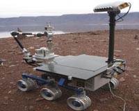
 AMASE 2009 Expedition Finishes
Moffett Field CA (SPX) Sep 22, 2009 Before we get into the blogs, you may have noticed that we were unable to post everyday while we were aboard Lance. Loss of internet contact is part of an arctic expedition, and we were not able to get the posts out until now that we are off the ship. We may be rocket scientists, but there are things that even this group can't do! So, with apologies for the belatedness of these posts ... read more |
|
| The content herein, unless otherwise known to be public domain, are Copyright 1995-2009 - SpaceDaily. AFP and UPI Wire Stories are copyright Agence France-Presse and United Press International. ESA Portal Reports are copyright European Space Agency. All NASA sourced material is public domain. Additional copyrights may apply in whole or part to other bona fide parties. Advertising does not imply endorsement,agreement or approval of any opinions, statements or information provided by SpaceDaily on any Web page published or hosted by SpaceDaily. Privacy Statement |